Trends of monitoring are the automation and continuity of measurements. The traditional monitoring measurements are carried out at certain time intervals. But now the information of the monitored objects should be available continuously in near-real-time, so that the users can know the possible danger as early as possible. This means the instruments should be set permanently on the monitored objects and thereby the investment costs for these are high.
The geodetic GNSS receivers that use carrier phase measurement can achieve accuracy of the sub-cm in relative mode. Besides the tachymeter, only GNSS receivers can measure the 3-dimensional positions automatically and continuously. For this reason, GNSS receivers were used very early in the monitoring. Different measurement methods have their advantages and disadvantages. One advantage of the GNSS receivers is they can be used under all weather conditions. Furthermore, direct line of sight is not necessary for the GNSS measurements. In addition, data collection and processing can be realized automatically and continuously. However, the geodetic GNSS receivers are not suitable for wide area due to their high price (some cost more than € 20 000).
Preliminary research IIGS showed that with the use of carrier phase data, the low-cost single-frequency receivers, which are developed for the mass market, and cost much less than 100 € (such as u-blox GPS receiver), can achieve similar accuracy as geodetic GNSS receiver. IIGS has developed an automatic low-cost GPS monitoring system, which includes u-blox L1 single frequency GPS receivers.
System Architecture
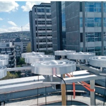
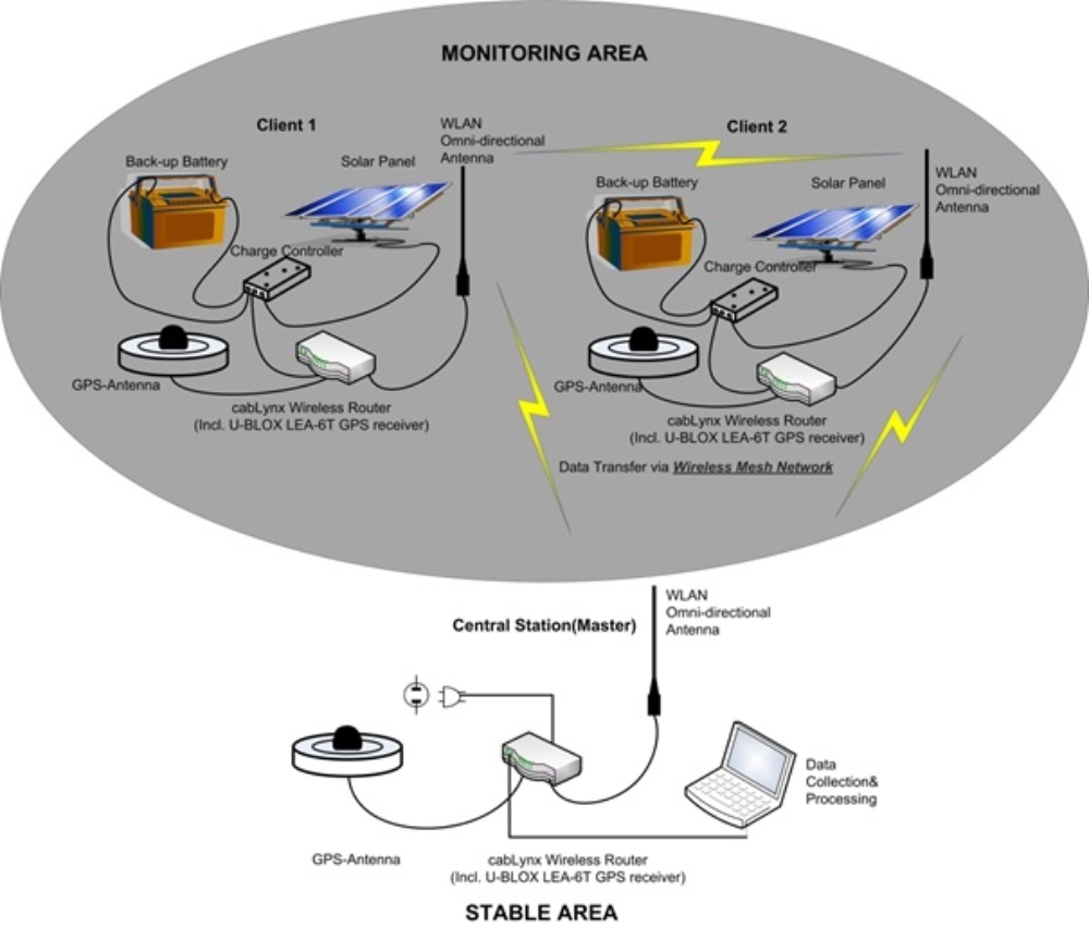
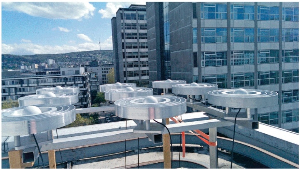
The test system consists of three stations. One station is operated as a central station (master) which controls the data communication and two stations (clients) which transfer the raw data continuously in real-time via Wireless Mesh Networks (WMN) to the central station. The central station is connected to a computer, data collection and processing is executed there. Basically, the router can also realize data transmission via UMTS. The results, e.g. the information of the baseline can be transferred via UTMS over the Internet through a VPN to the network of the University of Stuttgart. Since the WMN is self-organized and thus data transmission direction is variable and previously unknown, an omni-directional antenna is here necessary. The range of the WLAN communications has been tested up to 2 km with line of sight. To make sure that this system can run continuously and autonomously, the power of each station is provided with a solar panel, a solar charge controller and a back-up battery. The most important parts of each station is the latest (in year 2013) u-blox GPS receiver LEA-6T which is possible to output the GPS raw data in binary format and integrated in the CabLynx router. The self-constructed L1 optimized choke ring ground is used to reduce the multipath effect.
System Quality
A lot of quality evaluations were done with this system (compare publication list). New Low-Cost GNSS antennas and receivers can be used in this system as well. In general, this low-cost GNSS system (for short baselines up to several kilometers) can get an accuracy of up to mm in horizontal coordinates component and up to 1-2 cm in height.
Improvement of Quality by considering temporal and spatial corrections
The influence of multipath effects can be reduced at first by constructing and applying a self-constructed L1-optimized choke ring ground plane. The accuracies can be improved by about 50 %.
Furthermore, two coordinate-based methods are developed in order to reduce the oscillations in the time series which are probably caused by multipath effects. The temporal and spatial correlations between the adjoined stations with Low-Cost GPS receivers are taken into account (one method is based on temporal correlations and the other method on spatial correlations). The accuracy of the Low-Cost GPS measurements can be improved by about another 50 %.
By improving the accuracy of the measurements, the rate of failure to alarm, particularly for small deformations, can be reduced. The methods can deliver a near real-time solution: with a time delay of 30 minutes, the statement about the deformation will be delivered. In general, the correctness of the statement is improved by the two methods. The research results show that the quality of the Low-Cost GPS receiver system was improved by the two methods and by implementing the L1-optimized choke ring ground plane. The designed low-cost GPS receiver system represents a cost-effective, accurate and reliable system for monitoring applications.
Publictions
- Hassan, A., Xu, J., Zhang, L., Liu, G., Schmitt, A., Xing, C. Xu, Y., Ouyang, C., Schwieger, V. (2018): Towards integration of GNSS and GB-SAR measurements: Exemplary monitoring of a rock fall at the Yangtze River in China. In: FIG CONGRESS 2018, Istanbul, Turkey.
- Zhang, L., Schwieger, V. (2017): Investigation of a L1-optimized Choke Ring Ground Plane for a Low-Cost GPS Receiver-System. Journal of Applied Geodesy, Band 12, Heft 1, Seiten 55–64, ISSN (Online) 1862-9024, ISSN (Print) 1862-9016, DOI: https://doi.org/10.1515/jag-2017-0026.
- Zhang, L., Schwieger, V. (2017): Investigation of a L1-optimized Choke Ring Ground Plane for a Low-Cost GPS Receiver-System. FIG Working Week 2017, 29.05.-02.06.2017, Helsinki, Finnland.
- Zhang, L., (2016): Qualitätssteigerung von Low-Cost-GPS Zeitreihen für Monitoring Applikationen durch zeitlich-räumliche Korrelationsanalyse. (Dissertation) Hauptberichter: Prof. Dr.-Ing. habil. Volker Schwieger, Mitberichter: Prof. Dr.-Ing. Otto Heunecke, Prof. Dr.-Ing. habil. Lambert Wanninger, Bayerische Akademie der Wissenschaften, Verlag C. H. Beck, DGK, Reihe C, Nr. 776
- Zhang, L.; Schwieger, V.: Improving the Quality of Low-Cost GPS Receiver Data for Monitoring Using Spatial Correlations. In: Journal of Applied Geodesy 2016, 10(2): S. 119-129.
- Zhang, L.; Schwieger, V.: Improving the Quality of Low-Cost GPS Receiver Data for Monitoring Using Spatial Correlations. In: 3rd Joint International Symposium on Deformation Monitoring (JISDM), 30.03-01.04, 2016, Vienna, Austria.
- Zhang, W., Zhang, L.: Time Series Analysis of Different Shieldings of Low-Cost GPS Receiver. Proceedings on 2nd International workshop on “Integration of Point- and Area-wise Geodetic Monitoring for Structures and Natural Objects”, March 23-24, 2015, Stuttgart, Germany.
- Zhang , L.: Reducing Multipath Effects by Considering Spatial Correlation. Proceedings on 2nd International workshop on “Integration of Point- and Area-wise Geodetic Monitoring for Structures and Natural Objects”, March 23-24, 2015, Stuttgart, Germany.
- Zhang, L.: Time-Spatial Analysis for Low-Cost GPS Time Series. In: Karpik, A., Schwieger, V., Novitskaya, A., Lerke, O. (Hrsg.): Proceedings on International Workshop on Integration of Point- and Area-wise Geodetic Monitoring for Structures and Natural Objects. SSGA, Novosibirsk, Russia, 2014.
- Zhang, L., Schwieger, V.: Investigation regarding different antennas Combined with low-Cost receiver. FIG Working Week, Abuja, Nigeria, 06.-10.05.2013.
- Zhang, L., Schwieger, V.: Monitoring mit Low-Cost GPS Empfängern –Chancen und Grenzen. In GNSS 2013 – Schneller. Genauer. Effizienter. 124. DVW-Seminar on 14. - 15. 03. 2013 in Karlsruhe, Wißner Verlag, Augsburg, 2013.
- Zhang, L., Stange, M., Schwieger, V.: Reducing the Costs of Geodetic Monitoring. GIM International, September 2012.
- Zhang, L., Stange, M., Schwieger, V.: Automatic Low-Cost GPS Monitoring System Using WLAN Communication. FIG Working Week 2012. 6.-10.05.2012, Rom, Italien.
- Schwieger, V., Zhang, L.: Automated Geodetic Monitoring By Low-Cost GPS. Interexpo Geo-Siberia – 2012. 17-19. 04.2012, Novosibirsk, Russland.
- Schwieger, V., Zhang, L.: Automatisches geodätisches Monitoring mit Low-Cost GNSS. Messtechnik im Bauwesen, Spezial 2012, Verlag Ernst & Sohn, Berlin.

Li Zhang
Dr.-Ing.Senior Lecturer / Head of Section Quality Modelling and Sensor Fusion