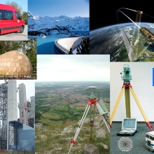
Project areas overview
- Brain TLS – Perceived Space Representation using Brain Activity Analysis, Eye-Tracking and Terrestrial Laser Scanning
- TransSec - Autonomous emergency manoeuvering and movement monitoring for road transport security
- Ghosthunter – Telematics system against Geisterfahrer using GNSS and digital maps
- HydrOs – Optimization of GNSS positioning in shadow areas on federal waterways
- Do-iT – Data optimisation for integrated telematics
- GPS for forest applications
- LowCost GNSS
- MOPSY – Modular Positioning System
- Positioning by mobile phones
- TanDEM-X – Worldwide PPP - evaluation of kinematic GPS measurements
- Mapmatching – Map Supported Positioning
- Geometric control for highly accurate construction machine guidance
- PoGuide - Modular expert system for automation of construction processes
- IntCDC - Cluster of Excellence RP16 "Integrative Computer-Based Planning and Building for Architecture"
- QuCon - Development of a Real Time Quality Support System for the Houses Construction Industry
- EQuiP - Efficiency optimization and quality control of engineering geodesy processes in civil engineering
Guidance of construction machines
- Geometric control for highly accurate construction machine guidance
- PoGuide - Modular expert system for automation of construction processes
Monitoring
- Precise Positioning with Low-Cost GNSS
- IMKAD - Configurations and description of deformation processes
- Model Evaluation - Sensitivity Analysis
- Integration of Point- and Area-wise Geodetic Monitoring for Structures and Natural Objects 14th – 15th April 2014in Novosibirsk, Russian Federation
- Precise Positioning with Low-Cost GNS
- Automatic Low-Cost-GNSS Monitoring System
- IMKAD - Configurations and description of deformation processes
- Sensitivity analysis - Model evaluation
- International Workshop Integration of Point- and Area-wise Geodetic Monitoring for Structures and Natural Objects 14th – 15th April 2014, Nowosibirsk, Russia
- Integration of Point- and Area-wise Geodetic Monitoring for Structures and Natural Objects
2nd International Workshop March; 23rd to 24rd 2015 Stuttgart, Germany
- Telematics system against Geisterfahrer using GNSS and digital maps
- Do-iT - Data optimisation for integrated telematics
- EuroRoadS - Pan-European Road Data Solutionan-Europäisches Straßendatenkonzept
- ROSATTE - ROad Safety ATTributes exchange infrastructure in Europe on roadmaps
- Quality propagation using artificial neural networks
- Positioning by mobile phones
- Map Supported Positioning
- Holistic Quality Model IntCDC RP18
- Quality propagation using artificial neural networks
- Do-iT - Data optimisation for integrated telematics
- EuroRoadS - Pan-European Road Data Solution
- ROSATTE - ROad Safety ATTributes exchange infrastructure in Europe
- QuCon - Development of a Real Time Quality Support System for the Houses Construction Industry
- EQuiP - Efficiency optimization and quality control of engineering geodesy processes in civil engineering
- Quality management
- Quality models
- Sensitivity analysis - Model evaluation
Project examples
Contact:

Volker Schwieger
Prof. Dr.-Ing. habil. Dr. h.c.Director of the Institute


