Procedure:
The data acquisition within the GSM network is network-based and can be evaluated by use of different geometries.
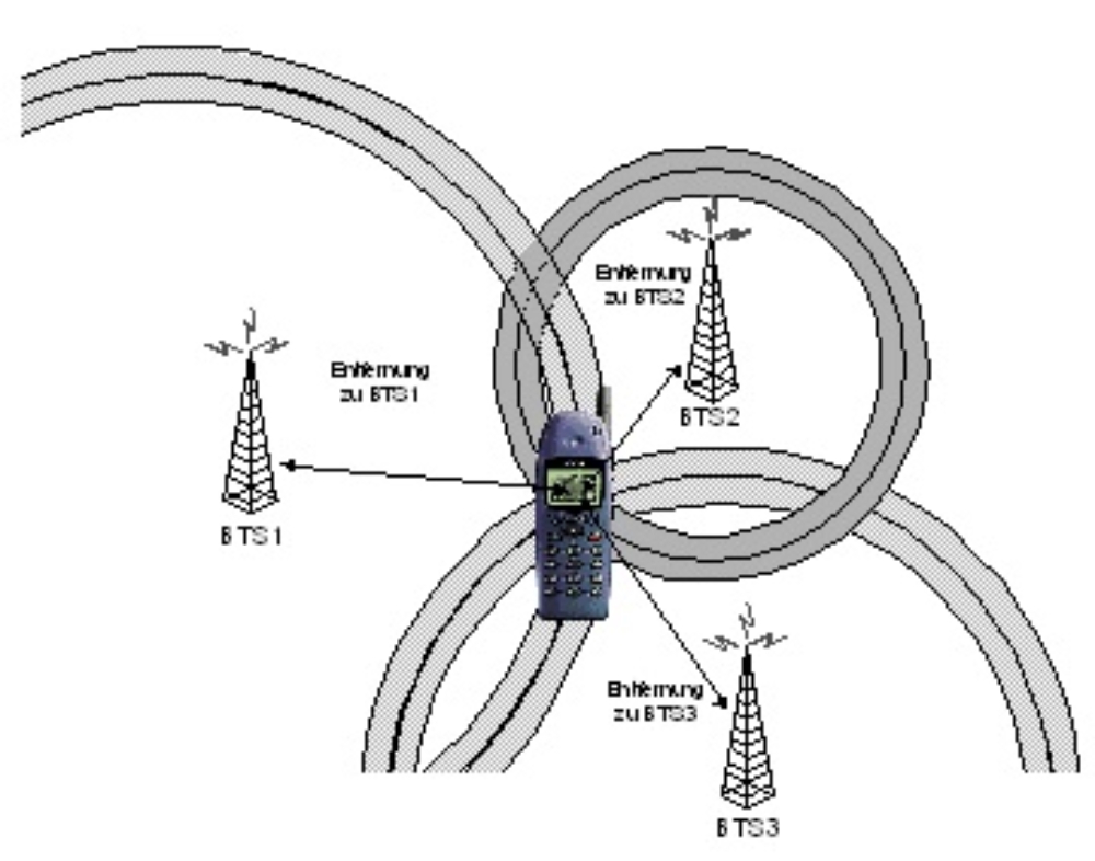
The figure above exemplary shows the use of distance data (derived of signal power or timing advance values between a mobile phone and multiple base transceiver stations, BTS) to determine the position by arc section. This method is called time of arrival (TOA).
Sequences of positions are fed into a filter algorithm and map matching methods are used to relate them to a digital road element. This research is currently done within a simulation.
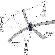
Observed time differences can be evaluated by methods called TDOA (time difference of arrival). Their solution is the intersection of hyperbolas. A special method is EOTD (enhanced observed time difference), which compensates the errors of time synchronisation between different BTS by the use of LMUs (location measurement units). The principle is shown in the following figure.

The achievable accuracy for these methods is evaluated and the positions determined are referenced to a digital map by the use of an adapted method of map-matching.
Contact:

Volker Schwieger
Prof. Dr.-Ing. habil. Dr. h.c.Director of the Institute